A Swift Utility Plan will allow you to determine if a prospective purchase has ready utility access, or where to start looking for the public utility connections on a property where works are to be performed (note that, once again, the locations of all services must be confirmed through on-site inspection before any works commence).
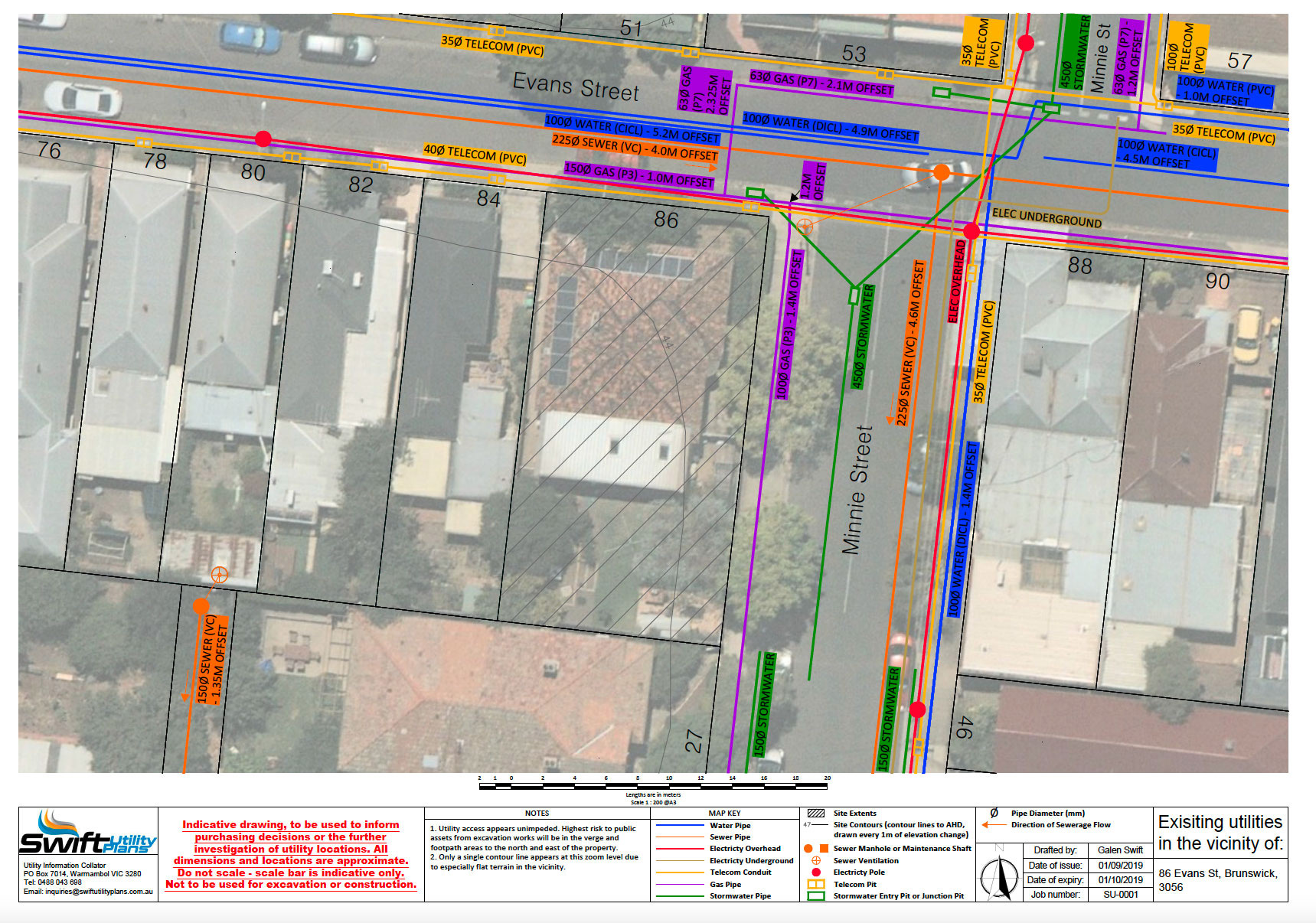
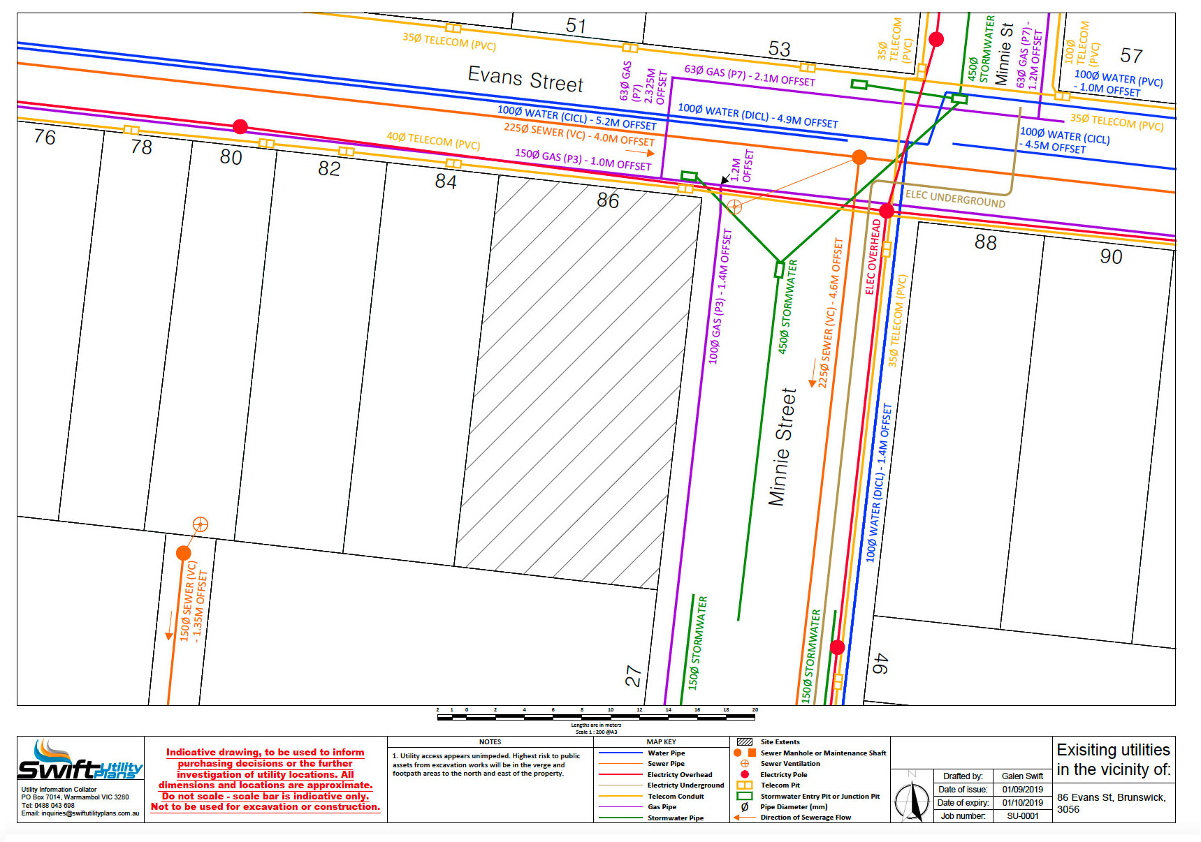
A sample plan, pictured both with and without additional options for inclusion of a superimposed aerial photograph and landscape contours, can be viewed below. Both samples contain the full set of queryable services.
A Swift Utility Plan can usually be read and interpreted with no special prior knowledge. However, if desired, a detailed summary of the components of a plan may be read below:
Queryable Services
You can choose to query any or all of the following services upon placing an order. At least one of these must be queried for an order to be placed. Utilities information is sourced from Dial Before You Dig.
Note: Offset is defined as the distance from a service to the nearest property boundary, easement, or other key reference lines. A single offset value listed for an entire length of pipe means the service runs parallel to its reference line. If it does not run parallel, the changes in offset will be listed at key points along the route.
WATER
Diameter (mm), pipe material, and offsets (m) will be shown. Water lines are indicated in blue.
SEWER
Diameter (mm), pipe material, offsets (m), and positions of sewer access points as provided by utility provider will be shown. Sewer lines and access points are indicated in orange.
ELECTRICITY
TELECOM
GAS
STORMWATER
OTHER
Information for any other, unusual services that may be in the area will be provided free of charge, and will vary depending on the exact nature of the service present.
Colour-coded key indicating the type of service or other feature represented by a given line or symbol on the plan.
Address of property under consideration (the property will also be highlighted on the plan itself)
Property boundaries overlay sourced from Land Victoria, including street names and property address numbers.
North arrow.
Scale bar displaying real-world distances in meters. Each plan will be issued at a scale appropriate for the property under consideration, though typical scales include 1:100, 1:200, 1:250, 1:500, and 1:1000.
Georeferenced aerial photographs of location (optional).
Surface contours overlay sourced from Land Victoria, showing the heights (in meters to AHD) of the land on the property under consideration and its surrounds (optional).
Information panel containing business name, contact information, job title, and date of plan issue.
For any additional clarifications or inquiries prior to or after placing an online order, please refer to the Contact page for contact information.